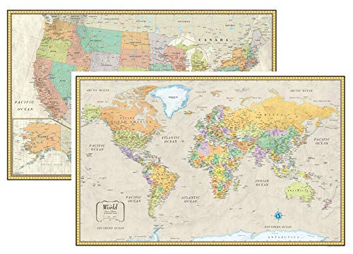
National Geographic: United States Executive Wall Map (36 x 24 inches) (National Geographic Reference Map)

CategoryAtlases & Gazetteers
National Geographic: United States Executive Wall Map (36 x 24 inches) (National Geographic Reference Map)
List Price: $31.37$28.23DEALYou Save: $3.14 (10%)
Free shippingFree Returns – 30 daysFree Order CancellationSecure Payment2–3 Days DeliveryGet It June 23, 2026In Stock (11)No marketing spamNo account requiredFulfilment by FedEx / Amazon / UPS / ShipwirePayPal / Card Buyer Protection
Customer Reviews
Reviews sourced from verified Amazon purchasers4.6
out of 5
Based on 10 reviews
5★
70%
4★
30%
3★
0%
2★
0%
1★
0%
Great colors
Knittingloie✓ Verified Purchase•March 25, 2017
The colors are excellent and there are a good amount of cities listed. I'm using it on a wall in my den to glance at if someone mentions where they live. I'm only giving a star off because the lamination is so thin. However, maybe that's good because so far I just have it stuck up with scotch tape.
Great wall decoration!
Ice Skater✓ Verified Purchase•August 19, 2016
Great, readable and durable map. I mounted it on a wall to mark our travels it map tacks. I mounted it on a piece of luan, and framed it with small pictures of the places we'd visited. What a great way to remember people and places!
Nice, large, detailed map.
Momster✓ Verified Purchase•August 4, 2015
Very large, detailed map - bought through Amazon (listed seller) and it arrived in perfect condition! Great idea to hang this on a wall where kids walk by it...they might happen to learn a thing or two from it! Couldn't hurt. This particular one is going to the UK for relatives. Hopefully give them a good idea how vast the US really is.
It's also a nice neutral color
Pandacansurf✓ Verified Purchase•April 26, 2015
This is incredibly well worth the value and the lamination is key. It helps prevent from people pointing at it and wearing out the color on the map. It's also a nice neutral color, so it goes with anything. Plus, the population density, vegetation, and south polar region sub maps are cool conversation pieces. I learn something new every time I actually spend time looking at it. Finally, it helps to keep the atlas eye level if you're going to hang it, or I suppose one could just roll it up and stow it somewhere.
A simple map, my son's childhood treasure
Doreen R.✓ Verified Purchase•December 9, 2014
This map was purchased to replace a map I had give my son in 2003. The original map was destroyed in a house fire last Feb. My son was badly hurt so his "things" were of no concern early on. He made an incredible come back, he's back into a new place. He's fully recovered and he's back to work. In his recovery journey he is now rebuilding. That map I had given him so many years ago turned out to be something he missed. He asked for replacement and since the map was given to me prior to my giving it to my son, IDK where it originated. I came to Amazon first, saw this map, and from what I could see it looked the same. My son said it's smaller than the original one and didn't include the smaller cities but was otherwise very similar. He was happy and sent me a photo of it on his wall. This is a prime example of how the smaller things in life can truly matter. Thanks for reading if got this far.
Page 1 of 2


![Grand Staircase, Paunsaugunt Plateau Map [Grand Staircase-Escalante National Monument] (National Geographic Trails Illustrated Map, 714)](https://m.media-amazon.com/images/I/41GsSMGrseL._SL500_.jpg)