SMA26 IMU RTK GPS Surveying Equipment Rover Base Handheld Collector, Survey Software,1cm-2.5cm Accuracy, 30°-60° Tilt, NOAA certificated (exclude Tripod&Pole)


Key features
- •Rover+base: SMA26 IMU RTK GPS Survey Equipment consists of SMA26 Rover and Base station and Collector with Permanently Valid Surveying software. Double SMA26 RTK GNSS receiver included, Rover and Base can be switched freely
- •Rover Base connection: Step 1: Connect collector with one SMA26 by BT to set as base, wait for 3minutes(important); Step 2: Stop connection with base, then connect collector with other SMA26 to set as rover; Step 3: Set same wireless protocol and channel on rover and base till fixed. Then you can start parameter setting and surveying job
- •Application: RTK GPS Survey Equipment GNSS receiver SMA26 Accuracy can meet various surveying & engineering, such as construction mapping&engineering, geographic information,mine surveying,topographic surveying etc. Fully support GPS, GLONASS, Galileo, BeiDou, QZSS systems, adapt to a variety of complex and harsh environments
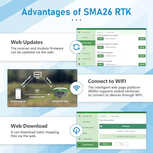
- •Features: Wireless, Storage, Positioning,Inertial Navigation, GNSS Antenna and other modules to meet various needs of measurement work. Collector with professional instruction,High precision, low power consumption, small size, easy to carry and operate
SMA26 IMU RTK GPS Surveying Equipment Rover Base Handheld Collector, Survey Software,1cm-2.5cm Accuracy, 30°-60° Tilt, NOAA certificated (exclude Tripod&Pole)
List Price: $4363.55$3927.20DEALYou Save: $436.35 (10%)
Free shippingFree Returns – 30 daysFree Order CancellationSecure Payment2–3 Days DeliveryGet It June 24, 2026In Stock (1)No marketing spamNo account requiredFulfilment by FedEx / Amazon / UPS / ShipwirePayPal / Card Buyer Protection